You may be tired of seeing mountain views, but these are the most unusual yet. We planned a day road trip to see the Chiricachua Mountains south of Willcox, AZ.(124 miles one way) I-10 goes through the Dragoon Mountains too, so we stopped by the Amerind Museum in Dragoon. Amerind has an extensive collection of ancient civilization artifacts, pottery, stone tools, early straw weaving and baskets. Although there are some from the Mayan and Incan period, most were collected here in AZ.
There is a fair and historical video of the surrender of Geronimo. There is never a good story to how we treated the native Indians. The warfare between settlers and Indians was brutal and tragic. I think of them as I gaze at the landscape and imagine their quiet way of co existing with the land, its seasons, and wildlife. History here is very evident.
There is both a museum and an art studio. We only had time for the museum.

This beautiful quilt will be auctioned as a fund raiser. We were restricted from taking pictures of any artifacts. So you'll just have to go to see the collection.
And this begins the unusual rock formations. These big chunks are plopped randomly on flat ground.
These smooth rocks piled up and scattered on the flat land represent stream and lake deposits from the time when AZ had a huge inland lake. They are very amusing.
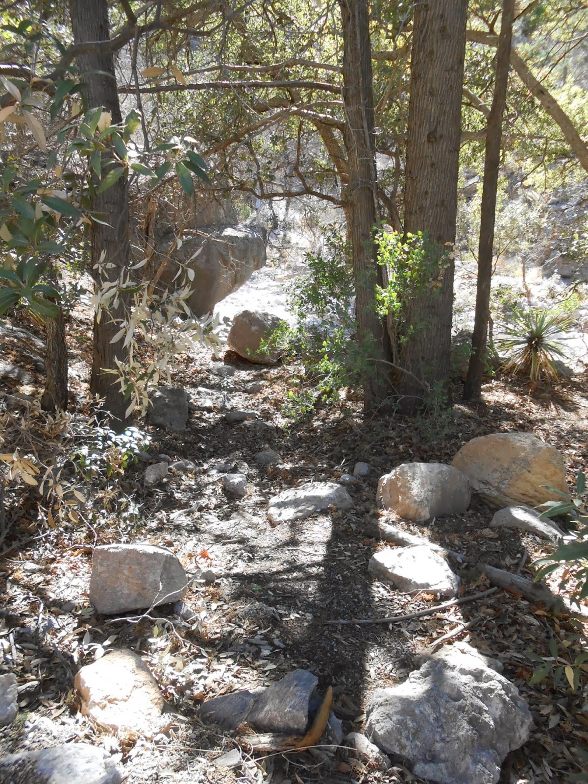
A great picnic spot.
I had to help hold this rock up
This is a tree truck which found space to grow in between these giant boulders
If I was a rattlesnake, I'd love to crawl up on these sun soaked rocks and get nice and toasty.
Ancient rocks, ancient trees
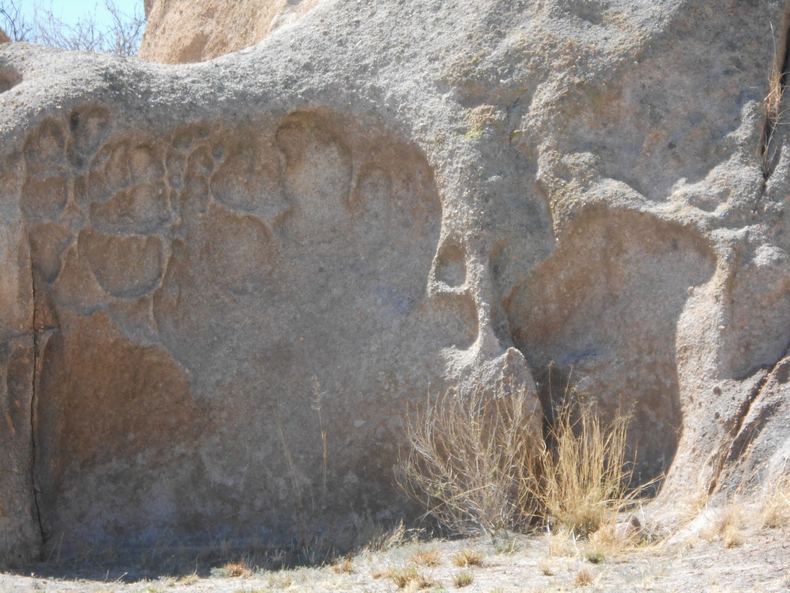
I'm sure there is a geological explanation for these dents, but I don't know what the answer it. have to ask a geologist.
Can you imagine being the first settlers in this territory.

The surrounding mountains

Heading for this distant Chiricahua Mountains
So far, lots of forest and a few big rocky outcroppings. We're heading for Massai Point.
First stop, the Information Center. We passed up this little trail and bought a great book about the CCC(Civilian Conservation Corps), "Our Mark on This Land, A guide to the Legacy of the CCC in America's Parks".
Tricky drive up which is why there are no pictures. Can't distract the driver. I'll just tell you that there was some "ear popping " from the change in altitude.
Massai Point was named for a famous Apache warrior who stole a horse from the Stafford Ranch and was chased to this point. He was not caught and was never seen again. Some say his spirit lives among the rocky columns.
So much wind that Jim left his hat in the car. it was a nice Arizona day, 70s, sunshine but a stiff wind up this high.
Our first view of the "Wonderland of Rocks" incredible columns of stacked rocks.
Chocise Mountain where he had his last stand and was captured. We didn't have time to visit that site, but we'll be back.
Wind blown ancient tree along side the path
This is Mount Harris. At Massai Point, we are 2000 feet above the valley. The mountain was named after the Harris Family of settlers who took a short cut through the Chiricahua Mountains but were killed by the Apaches.
The red dotted line represents the caldera left after the volcanic eruption.
Hard to imagine that much violence over such a huge area. But something has to explain these mountains and rock formations that we see millennia later.
The exhibition building. Thank you to the CCC for the steps they built so long ago.
The path down.
This trail reminds me of Bright Angel Path in the Grand Canyon.
Here's the path. I wimped out before the turn at the end of the path.
Here's the explanation for these stacked rocks. Superheated volcanic ash deposits were slowly compressed and fused together. Rain, wind, freezing and thawing have washed away weaker material leaving these incredible rounded and smoothed formations.
Looking down at the valley below as Jim drives down the mountain.
That's our road over there.
2011 remains of a forest fire. This is the outside of the Wonderland of Rocks mountain's side of columns and pinnacles.
Finally a bit of straight road. But still to come, more rock pinnacles to see from below now instead of from above.

This trail is for Jenne, Craig and Emmett when they come to AZ someday

The path curves around that big boulder
Even a sliver of moon can be seen hanging over the mountains

Many formations are named. Organ Pipe is especially impressive. What a glorious sound if these pinnacles could sing.
Last views as we head down to the entrance.
Bonita camp ground facilities. Note the sand bags. Have to pay attention to rain in these canyons,
Imagine settling on land with these mountains as a back drop view every day
We started out to see the ranch buildings....... and...... my camera said BATTERY EXHAUSTED. I don't blame it for being exhuasted. We'll be back and take some more pictures of this historic site another day


No comments:
Post a Comment